Chesil Beach - Formation

Background Information

During the Last Glacial Maximum, 10 000 years B.P., Chesil Beach would have been an offshore bar of sediment.  Sea levels at this time were as much as 120m below current O.D., and the shoreline would have been very different.  As sea levels have risen and the climate has warmed, the bar of sediment has moved northwards, following the rising sea level and the retreating coastline.  The current landform (a tombolo) has become anchored by the land, with Chesil Beach now starting at West Bay and extending approximately 27 km to the east to join the Isle of Portland to the mainland.  The current direction of the littoral cell is from west to east along Chesil Beach, however the sediment size is graded with the largest pebbles found in the east (attrition should make pebbles smaller in this direction).  This shows that a past littoral cell must have moved pebbles by longshore drift in the opposite direction.


Chesil Beach towards the western margin at West Bay


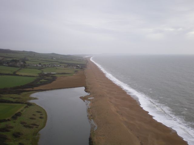
Chesil Beach looking eastwards towards the Isle of Portland, which is just visible in the distance.

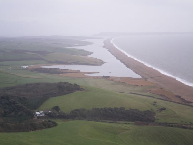
Chesil Beach at it's easten end, where it joins the Isle of Portland to the mainland.  The village of Chiswell is in the foreground.  The oil terminal is no longer there and the site is being redeveloped to host the sailing events at the 2012 Olympic Games.  The Fleet Lagoon is just visible to the left of the image.

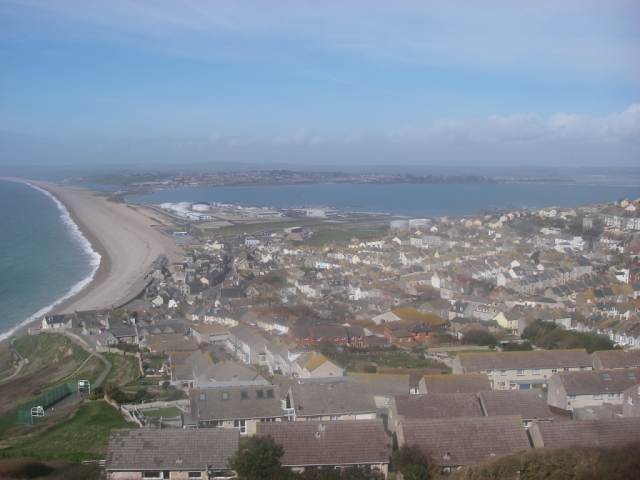
Chesil Cove, at the eastern margin of Chesil Beach.  This image shows the precarious location of some of the houses in Chiswell, which lie below sea level and which are vulnerable to coastal flooding by both peroclation and over-topping.  Major flood defences have significantly reduced the risk.  Berms (strom ridges) are clearly visible on this section of the beach.