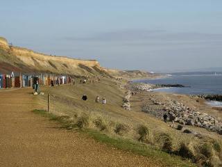
Barton-on-Sea - Coastal Management
http://www.yourlocalweb.co.uk/images/pictures/11/18/cliffs-and-beach-at-barton-on-sea-109726.jpg
Self-Study Guide
Resources:-
1. Coastal Management (16-19 Booklet)
2. Geofactsheet 207 - Management at Barton-on-Sea
3. Landform Systems (Bishop and Prosser) p. 121-123
Tasks:-
1. Draw an annotated map to show the location of Barton-on-Sea. Highlight the prevailing wind direction, the direction of sediment transfer and the main land uses at the coast.
2. Draw a cross-section of the cliff at Barton-on-Sea. Label the geology and describe the problems that are likely to occur in these cliffs.
3. Explain the cliff-foot and cliff-face processes that lead to rapid erosion at Barton-on-Sea. State the rate of erosion of the cliffs prior to the introduction of management.
4. Describe and explain the management strategies that have been used at Barton-on-Sea to reduce the rate of cliff erosion.
5. Identify the different groups of people who are likely to hold strong opinions about the management at Barton-on-Sea. Summarise the opinions of each group.
6. Evaluate the success of the management at Barton-on-Sea. Some of the evaluation should consider the success of the management in reducing cliff retreat, and some should consider the view-points of the different groups (stakeholders) who have an interest in this section of the coastline. | 